UGANDA is a unique country with various features like national parks. Uganda has many parks among which include;
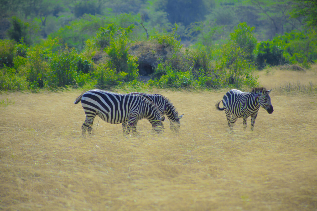
QUEEN ELIZABETH NATIONAL PARK
Queen Elizabeth National Park (QENP) spans the districts of Kasese, Kamwenge, Rubirizi, and Rukungiri. The park is approximately 400 kilometres (250 mi) by road south-west of Kampala, Uganda’s capital and largest city. The city of Kasese lies to the northeast of the park, while the town of Rubirizi is to the southeast.The park adjoins Kyambura Game Reserve to the east, which itself adjoins the Kigezi Game Reserve (including the Maramagambo Forest) and thus the Kibale National Park to the northeast. The Virunga National Park in the Democratic Republic of the Congo lies across the border to the west. Together, these protected places completely encircle Lake Edward. The Rwenzori Mountains National Park in Uganda lies not far to the northwest.
Confusingly, during the 1970s and 1980s, Western conservationists usually referred to the park as Rwenzori National Park
LAKE MBURO NATIONAL PARK
Lake Mburo was originally gazetted in 1933 as a controlled hunting area and upgraded to a game reserve in 1963. The region was settled by Banyankole Bahima pastoralists who traditionally herd Ankole cattle, and still do.
The residents continued to graze their cattle in the reserve, a situation decried by western conservationists, who termed them “invaders” in 1981, but were expelled from their lands after it was upgraded to national park status in 1983, as hoped for by some in the West. The Obote government‘s upgrade decision was intended, in part, to weaken the Banyankole, who supported anti-Obote rebels. It came at the time of the Operation Bonanza massacre of 300,000 people during the Ugandan Bush War. As the evicted pastoralists were not compensated for lost grazing land or assisted with resettling, many remained hostile to the upgrade. The rangeland outside the park was subsequently subdivided into small ranges and subsistence farming plots.
In 1985, the second Obote regime fell and the previous residents of Lake Mburo re-occupied the park’s land, expelling park staff, destroying infrastructure, and killing wildlife. Less than half of the park’s original land area was eventually re-gazetted by the National Resistance Movement government in 1986.
Within the park there are still culturally significant locations, such as Rubanga, where sacrifices were once made to the gods; Ruroko is where the semi-mythical Bachwezi lived, and Kigarama was where the servants of the king used to stay
Bwindi Impenetrable Forest NATIONAL PARK
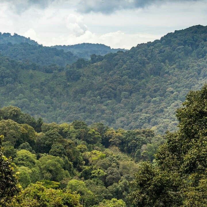
The Bwindi Impenetrable Forest is a large primeval forest located in south-western Uganda and is located in three districts of Kisoro, Kabale and Kanungu. The Bwindi forest is on the edge of the Albertine Rift, the western branch of the East African Rift, at elevations ranging from 1,160 to 2,607 metres (3,806 to 8,553 ft). The forest contains around 160 species of trees and over 100 species of ferns. Bwindi Impenetrable Forest Reserve was set up in 1942 on the rim of the Rift Valley
The name Bwindi is derived from the Runyakitara word Mubwindi and means “a place full of darkness”.This name comes from the extensive stands of bamboo interspersed amongst the larger forest hardwoods. The bamboo and thick ground cover of ferns, vines, and other plant growth severely hinder direct access on foot. Also known as the “Place of Darkness”, the forest is on the edge of the western arm of the Great Rift Valley, only a few kilometers from the Democratic Republic of the Congo (DRC) border and about 25 kilometres (16 mi) north of the Virunga Mountains.